There are a limited number of clutter codes in the clutter attenuation file. The code names may not match the real-life type clutter for a given area. Or you may want to rename a clutter code to more accurately describe the clutter type.
For example if the clutter code name is snow and you don't want snow, then you can rename it something else to better fit your clutter.
It is important to note the actual data contained for each category is what matters, no data is derived from the ‘name’ of the clutter category.
For example, a desert and an ice plain could both have similar elevations, so that’s what the user should be looking at in order to validate the data.
You can also create a different attenuation file if you want with to use your own clutter names, clutter heights and attenuation values. You can do this by pressing Edit Attenuation File from within the Databases> Land Use(clutter) menu. This is what that dialogue will look like:
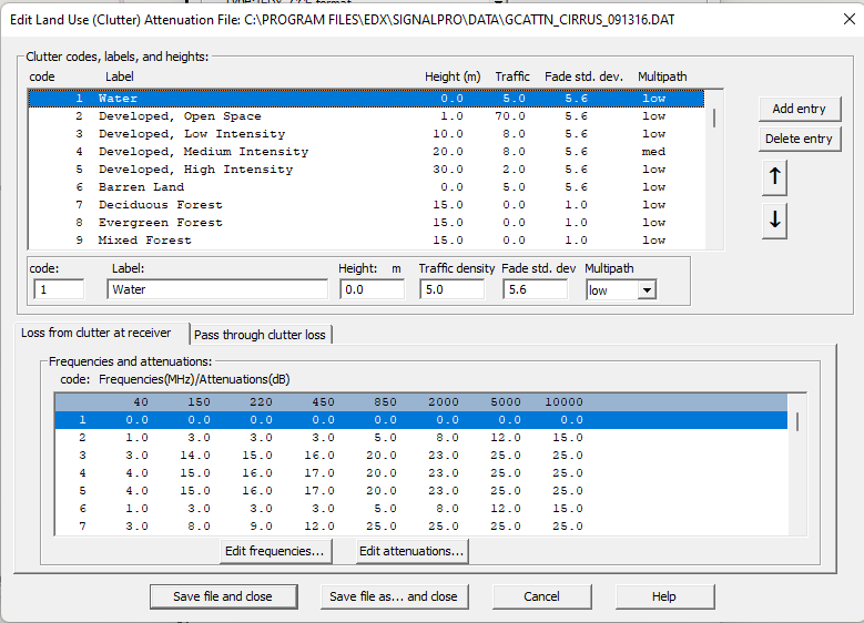
It would be best practice to press “Save file as… and close”. Save a copy of the attenuation file, then make edits to the copied attenuation file.
Tip: look at the actual area, using bing or Google if necessary and compare the real world elevation to what is contained in the attenuation file.