To create poles along streets you will first need street BNA data to import into the software. If you don't have streets data you can follow the link below to access the EDX US GIS Dataset.
https://edx.egnyte.com/dl/VO15tRWS3h
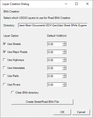
Once you download and extract this data you can go to Databases → EDX Geographic Data and point to the appropriate folder (NW, SW, NE, SE) as the database directory. You’ll also need to point to C:\Program Files\EDX\SignalPro\Library Data\edx_us_gis_layers.dat as the EDX US layer name file. Once this is set up you should have the US Geographic Data layers available in the map layers you can add.
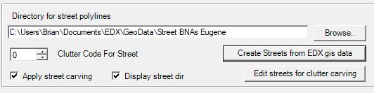
Then you’ll go to Databases → Land Use → Carve Clutter and use the Create Streets from EDX GIS data to extract the streets from your study grid area into a folder you specify for the BNA files.
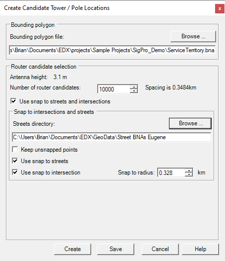
Once you have created the BNA files for the streets go to Databases → Towers/Poles and point to your service area polygon down at the bottom of the dialog, then select Create along streets and click Create Points. Here you can set up the number of towers you’d like, point to the BNA folder for streets, and click Create to generate a set up poles along the BNA streets. Once the locations have been created you can save them as a Tower/Pole database file.