SignalPro can accept RF planning best practices requires a seamless manner in which files can be transferred within other solutions for consistency
As such SignalPro has built in functionality that allows for many different geographic file formats for import . These can be imported within the Map Layers menu. Some formats are more preferred than others. Utilizing these
Utilizing the formats/steps below is considered best practice for bringing complex geographic files into SignalPro.
...
...
Michael please can you add screen shot of a file being imported and in SP map
MapInfo MIF and MID, or BNA, are our preferred formats for loading large/complex geometries into SignalPro.
KML, SHP, and TAB files are also supported , (but support is more limited.limited due to on-going 3rd party changes)
| Info |
|---|
Most algorithms and automations within SignalPro require a BNA file |
--Michael please define which - this is a very vague comment
EDX recommends converting all GIS data files into MapInfo MIF and MID format first before loading into SignalPro.
To do this, follow the steps below:
...
Open in MapInfo
...
Disaggregate
...
Save as MIF + MID
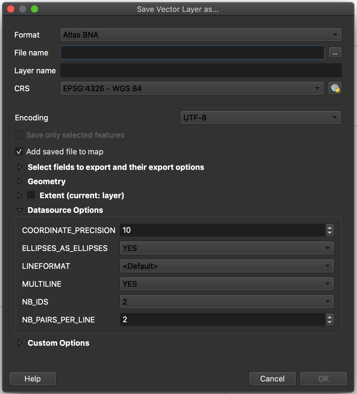
If a BNA conversion is necessary, convert the MIF and MID to BNA using QGIS, a free software available for download: https://www.qgis.org/en/site/
To convert the file, follow the steps below:
...
Open MIF and MID in QGIS
...
Export to BNA: From Layers panel, select layer → right click → Export → Save Feature As → Format: “Atlas BNA”
Michael Lauber please can you add pictures of it in signalpro after conversion