...
The resolution of the terrain and clutter databases you’re using:
5m, 10m, 30m, etc. The finer the resolution of your data, the more likely your results will match up. The more coarse your resolution of terrain and clutter data, the more likely you will see a difference in the area study and multipoint study results.The number of radials and the study point spacing along the radial in the Transmitter base station setup:
Attached is an image of the Study Sector/ Study range menu from within an individual Transmitter site details. Depending on your setup of the Study point spacing on path you can potentially see differences in your area study and multipoint study. It is usually best practice to set this value to the resolution of your clutter data.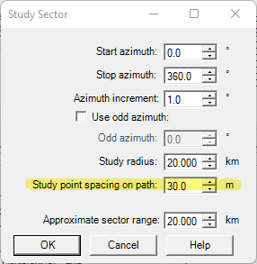

The study grid bin spacing:
You can find this menu under the menus: Studies>Define Study Grid. Attached is an image of the dialogue with the study grid bin spacing highlighted. This selection can also effect your area study and multipoint study results. This option effects the final resolution of your study results and also as well as the calculation time as well. The more coarse your resolution, the fewer points you will have for the grid height and width, the faster your study will run and the results will look more pixelated. The more fine your resolution the more points you will have in the grid height and width, the longer the calculations will take to complete and the better your results will look. So it is a bit of a tradeoff, but this can lead to seeing differences in results for the area study and the matching point to multipoint study.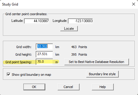

Whether you’re using radial line or grid optimized radials for the area studies:
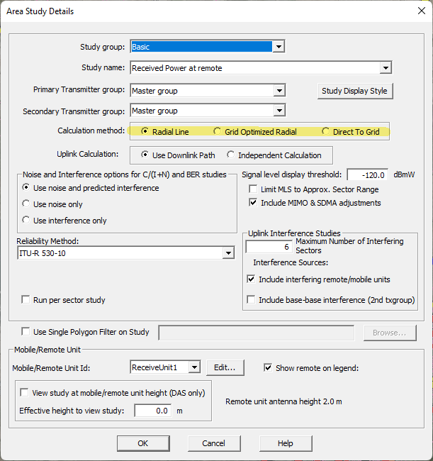
The calculation method selection under each individual area study details menu can also sometimes produce slightly different results for the area study and matching multipoint study. Each calculation method is different and will effect how long the study takes to calculate. With the Radial Line method being the fastest and most used, this selection takes into account the study point spacing on path mentioned above. This method calculates study results along each radial based on the study point spacing and completes from the start to stop azimuth for the full length of the study radius. Grid Optimized Radial will provide a substantial increase to calculation time but increases prediction accuracy at long distances. Direct to grid will take the longest to calculate. This method calculates the center of each bin in the study grid, then accesses the terrain/clutter, etc. and produces the study result for each study grid bin point, instead of along the radials.
If you still have further questions please submit a support ticket here: https://edxwireless.atlassian.net/servicedesk/customer/portal/2